ROUTE 66 CENTENNIAL · DEPARTING AUGUST 15, 2026

W6R

Route 66 Centennial
Special Event Station

Three Hams Eight States 2,400 Miles One Historic Highway

W6R Route 66 Centennial expedition badge featuring the callsigns N9WD, K9XH, and WB8VVK
CHICAGO, ILLINOISSANTA MONICA, CALIFORNIA

THE EXPEDITION

Family, radios and fun
on America’s Main Street.

In 2026, Route 66 turns 100. To mark the centennial, a father and two sons are driving the historic highway from Chicago to Santa Monica, operating special event station W6R along the way.

This is our field journal: the roads, people, meals, signals and unexpected moments we find along the way.

ROUTE 66 CENTENNIAL EXPEDITION
2,448MILES · 8 STATES · 100 YEARS
DAY 1ChicagoIllinois
DAY 2St. LouisMissouri
DAY 3TulsaOklahoma
DAY 4AmarilloTexas
DAY 5Santa FeNew Mexico
DAY 6FlagstaffArizona
DAY 7KingmanArizona
DAY 8Santa ClaritaCalifornia
DAY 9Santa MonicaPacific Ocean

THE STORY BEHIND THE JOURNEY

CHICAGO TO SANTA MONICA

The Mother Road is calling

In 2026, Route 66 turns 100—and three hams from one family are answering the call. A father and his two sons will point west from Chicago and drive the entire historic highway to Santa Monica: eight states, nearly 2,400 miles and a century of American roadside history.

Along the way, W6R will take to the air from memorable stops across the Mother Road. We’re not chasing a rigid operating schedule. We’re chasing the places, people, signals and unexpected stories that make a great road trip. Each evening, we’ll share the day’s photographs and field notes here. The radio is packed, the route is marked and the Pacific is waiting.

THE ROUTEChicago to Santa Monica
THE CREWN9WD · K9XH · WB8VVK
THE MISSION8 states · 2,400 miles · W6R

FIELD NOTES

Day by day.

One entry for each day on the Mother Road—written after the driving is done and the radio is packed away.

08
AUGUST 22, 2026 · SANTA CLARITA, CA → SANTA MONICA, CA

End of the Trail

We left for Santa Monica around 9:30 this morning, ready to complete the final leg of our Route 66 journey. Traffic was heavy, of course, because we were in Southern California, where traffic always seems to be heavy.

After a long stretch of slow, bumper-to-bumper driving, we reached the Santa Monica Pier and the celebrated end of Route 66. We explored some of the shops, took plenty of pictures, and walked to the end of the pier. Naturally, we also bought a few final Route 66 magnets and pins before heading back to the car.

One week ago, we began this journey in Chicago. Today, after traveling the full 2,448 miles of the Mother Road, we completed our Route 66 expedition at the Pacific Ocean.

Before leaving Santa Monica, we turned on the radio and spent about an hour operating from the parking lot. W6R made several more contacts on 20 meters, giving us one final opportunity to share the expedition over the air before shutting down the radio.

We finished the day with a celebratory lunch at Newhall Refinery in Santa Clarita. Over lunch, we looked back on everything we had experienced during the past week and continued to plan and dream about possibly making another Route 66 journey next year.

It has been an unforgettable trip for all three of us. We are grateful that we were able to share it with the stations we contacted along the way and with everyone who followed our progress through the website. Please feel free to leave a message in our website logbook or contact us individually using the personal call signs shown on the site.

Thank you for coming along for the ride.

73. W6R clear.

ROUTESanta Clarita → Santa Monica
RADIOFinal 20M contacts
MILESTONEEnd of Route 66
LUNCHNewhall Refinery

AUGUST 22 · DAY 8

The final day in pictures.

A curated selection from Santa Clarita to Santa Monica, capturing the final miles, the Pacific Ocean and the crew at the end of the Mother Road.

01Southern California traffic on the final drive toward Santa Monica.
02A bicyclist mural along the streets leading toward the Pacific.
03Making our way through Santa Monica with the ocean drawing closer.
04The colorful gateway to the Santa Monica Pier comes into view.
05Our first glimpse of the Pacific at the end of Route 66.
06Arriving at the entrance to the historic Santa Monica Pier.
07The expedition vehicle parked at the final destination.
08A busy Saturday crowd along the Santa Monica Pier.
09The Route 66 End of the Trail sign on Santa Monica Pier.
10The W6R crew together at the end of the Mother Road.
11Celebrating the completed journey with Santa Monica Beach behind us.
12Santa Monica Beach and the Pacific Ocean on a sunny August afternoon.
13The pier’s Ferris wheel rising above the final Route 66 stop.
14The crew at the Last Stop Shop’s Route 66 tribute wall.
15A Route 66 display marking the 2,448 miles from Chicago to Santa Monica.
16A Santa Monica Route 66 shield commemorating all 2,448 miles.
17The expedition vehicle’s final collection of Route 66 badges.
18W6R crew, 73 from the end of the pier.
07
AUGUST 21, 2026 · KINGMAN, AZ → SANTA CLARITA, CA

The Sidewinder, wild burros and the Mojave heat

The hotel staff had informed us that the water would be shut off at 9:00 this morning, so we made sure to leave around 8:30. Our destination for the day was Santa Clarita, California, where we planned to spend the night before completing our Route 66 journey Saturday in Santa Monica.

As we loaded the car and set up the radio, we discovered that we could not get an acceptable SWR on any band. We traced the problem to the coax connection at the antenna and decided to repair it while we were still in the hotel parking lot. Resoldering the connection and reassembling the antenna took about 30 minutes, but we were finally able to get back on the road.

Our first stop west of Kingman was Cool Springs Station. During its glory days, it was a gas station and an important stop for travelers along Route 66. Today, the restored station serves as a gift shop and small museum. The woman working there told us that her family moved to the area in 1926 and opened the original gas station. With no modern conveniences available in such a remote location, they used divining rods to locate the springs that still provide water there today. We bought a few things and continued west.

From Cool Springs, we entered the Arizona Sidewinder, an eight-mile stretch of historic Route 66 containing 191 curves, turns, and switchbacks. The narrow road winds through the Black Mountains toward Oatman, with tight turns, steep climbs, and few guardrails. At one point, the GPS estimated that traveling six miles would take us about 30 minutes. We stopped several times along the way to take pictures of the road and the surrounding desert.

About 40 minutes later, we arrived in Oatman, a former gold-mining town along Old Route 66. For a ghost town, it was a very busy place. We walked a couple of blocks through town, visited several shops, and met some of the wild burros that wander freely along the main street. The burros were friendly and walked right up to us.

Continuing west through the high desert, we passed a landscape covered with sagebrush and dotted with house trailers. Just outside Oatman, we were finally able to make several W6R contacts on 20 meters. The noise level was probably the lowest we have encountered during the trip, and most of the stations were coming in loud and clear.

We soon crossed the Arizona state line into California near Needles, but we did not stop again until we reached Roy’s Motel and Café in Amboy. Roy’s was once a well-known motel, café, gas station, and service stop for travelers along Old Route 66. The gas station and gift shop are still operating today, and the property remains one of the most recognizable landmarks on the California portion of the Mother Road.

A short distance west of Roy’s, we made a quick stop at Amboy Crater National Natural Landmark. We admired the volcanic crater from the car but decided against hiking to it because the temperature had reached 112 degrees. We wanted to survive long enough to finish our journey.

A large section of Old Route 66 was closed as we continued west, forcing us to detour around it. We also encountered several shorter sections that were closed for repairs, requiring us to follow unpaved bypasses around the construction.

Our next stop was the Bagdad Café in Newberry Springs. The café was used as the principal filming location for the 1987 movie Bagdad Cafe. Today, it operates primarily as a Route 66 attraction and gift shop filled with memorabilia from the film.

Farther west, we stopped at Elmer’s Bottle Tree Ranch near Oro Grande. The two-acre property features more than 200 metal “trees” covered with colorful glass bottles and assorted pieces of roadside Americana. It was one of the more unusual and distinctive stops we have encountered along Route 66.

As we approached the Los Angeles area, we took one final opportunity to operate the radio and completed one more contact. We have family in the area, so we spent the night with them in Santa Clarita and enjoyed a home-cooked dinner.

Tomorrow, we will complete our Route 66 journey at Santa Monica, California.

ROUTEKingman → Santa Clarita
RADIOSeveral 20M contacts
ROADSIDE STOPOatman
DINNERHome-cooked with family

AUGUST 21 · DAY 7

Today in pictures.

A curated selection from Kingman to Santa Clarita—from the Sidewinder and Oatman’s wild burros to Roy’s, Amboy Crater, the Bagdad Café and Elmer’s Bottle Tree Ranch.

01The W6R call sign ready for another day on the Mother Road.
02Resoldering the antenna connection in the hotel parking lot.
03Reattaching the repaired antenna connection before leaving Kingman.
04The winding road west toward Cool Springs and the Black Mountains.
05A Historic Route 66 shield painted on the Arizona pavement.
06The expedition vehicle arrives at Cool Springs Station.
07The restored stone exterior of Cool Springs Station.
08Vintage gas pumps recall Cool Springs’ days as a roadside service station.
09Route 66 badges and souvenirs inside the Cool Springs gift shop.
10A rusted automobile clings to the rocky hillside along the Sidewinder.
11Only 2.2 winding miles remained before reaching Oatman.
12An Oatman burro comes over to greet us through the car window.
13Two of Oatman’s wild burros pause beside the road.
14Old West storefronts lining the main street through Oatman.
15Oatman’s burros gather beneath a colorful Route 66 mural.
16The historic Oatman Hotel in the center of town.
17A playful Oatman take on the familiar Route 66 corner sign.
18The W6R crew together on Oatman’s busy main street.
19Working 20 meters from the front passenger seat near Oatman.
20Wild burros roaming the open desert west of Oatman.
21A Route 66 pavement shield welcomes us to California.
22The expedition vehicle beneath the famous Roy’s sign in Amboy.
23Route 66 memorabilia in the drinks-and-snacks window at Roy’s.
24A Historic Route 66 marker hanging beneath the canopy at Roy’s.
25Amboy Crater rising from the floor of the Mojave Desert.
26The entrance to Amboy Crater National Natural Landmark.
27The weathered exterior of the Bagdad Café in Newberry Springs.
28A memorabilia-covered booth inside the Bagdad Café.
29The three of us together outside the Bagdad Café.
30Bottle trees crowd around an old city-limits sign near Oro Grande.
31The entrance to Elmer’s Bottle Tree Ranch.
32A colorful welcome assembled from signs, stickers and roadside relics.
33The W6R crew among the bottle trees and desert artwork.
34Glass bottles and found objects transformed into roadside art.
35Sunset in Santa Clarita at the end of our final full day on the road.
06
AUGUST 20, 2026 · FLAGSTAFF, AZ → KINGMAN, AZ

Old Route 66 towns, desert trains and a radio repair

We left our hotel in Flagstaff around 9:15 this morning and headed west toward Kingman. Our first stop was Williams. On the way there, I tried calling CQ on 20 meters, even though the only signal I could find was a net that was just shutting down. One station responded to my call, but the signal was too weak to copy. The band was otherwise completely dead.

We walked through downtown Williams along Historic Route 66, took some pictures, and bought a few more pieces of Route 66 memorabilia. Before leaving for Seligman, we topped off the gas tank because we would be traveling a long distance with no gas available.

Along Old Route 66, we passed a series of Burma-Shave signs that we wanted to photograph. After missing them, we turned around and discovered another set facing the opposite direction, so we were able to photograph both. As we continued west, we came across several more sets. Had we known how many there were, we probably would not have turned around for the first ones.

When we arrived in Seligman, we stopped for pictures with the sign proclaiming it the birthplace of Historic Route 66. The town was crowded with tourists, so after taking some pictures, we continued on. Seligman seemed more touristy than historic, but it was still an interesting stop.

Most of the tourists must have turned around in Seligman because we soon found ourselves on a quiet and rather desolate stretch of Old Route 66 heading toward Peach Springs. This is a busy railroad corridor, and we saw many freight trains crossing the vast, open landscape. From miles away, some of them looked like tiny HO-scale model trains.

Peach Springs did not have much to offer, so we continued to Hackberry, Arizona, and stopped at the Hackberry General Store beside the road. We took plenty of pictures and bought still more souvenirs. A vintage police car with a large red “bubblegum machine” light on its roof attracted a lot of attention.

We sat in the parking lot for a while and tried to make contacts on both 20 and 40 meters without any luck. Then the SWR suddenly began fluctuating wildly. We determined that the cable connector at the back of the radio was coming loose, so we planned to buy a soldering iron in Kingman and attempt a repair.

A couple of miles farther down the road, we stopped briefly at another roadside shop to take a few pictures but did not go inside. It also had a vintage police car on display, although this one was a Corvette. From there to Kingman, there was little to see except vast open spaces and more trains.

We traveled only about 135 miles today and reached Kingman around 2:30 p.m. It was a little early for check-in, but our room was ready. For the second consecutive day, we had to hurry to unload the car as another thunderstorm bore down on us.

Once we were settled, we went to Home Depot and bought a soldering iron. Back at the hotel, we repaired the loose radio cable in our room and should be ready to try getting W6R back on the air tomorrow.

We did not feel like going out again, so we ordered dinner from Chili’s and ate in the room.

Tomorrow we plan to continue west and spend the night in Santa Clarita, California. On Saturday, we will make the final drive to Santa Monica and the end of Route 66.

ROUTEFlagstaff → Kingman
RADIO20M and 40M · no contacts
ROADSIDE STOPHackberry General Store
DINNERChili’s

AUGUST 20 · DAY 6

Today in pictures.

A curated selection from Flagstaff to Kingman, following Historic Route 66 through Williams and Seligman to Hackberry’s roadside relics and an evening radio repair.

01Trying 20 meters from the mobile W6R station on the way to Williams.
02The road into Williams beneath a gateway honoring the town’s railroad history.
03Route 66 artwork welcomes travelers to historic downtown Williams.
04The W6R crew together at Williams’ Route 66 Centennial sign.
05A vintage tanker car recalls Williams’ long connection to the railroad.
06A classic Route 66 shield beneath the wide Arizona sky.
07Vintage pumps outside Pete’s Gas Station Museum in Williams.
08Historic storefronts lining Route 66 through downtown Williams.
09The expedition vehicle beside a Route 66 Centennial railcar in Williams.
10Todd and Mike try on a little Western style in Williams.
11The beginning of Arizona’s longest remaining continuous stretch of Route 66.
12The colorful Snow Cap Drive-In along Route 66 in Seligman.
13The expedition vehicle at Seligman’s Birthplace of Historic Route 66 sign.
14A crew selfie at the Seligman Route 66 sign.
15A souvenir-covered roadside shop in Seligman.
16A long line of mailboxes beside a quiet stretch of the Mother Road.
17The weathered exterior of the Hackberry General Store.
18Todd and Mike take a break outside the Hackberry General Store.
19Vintage gas pumps and layers of Route 66 memorabilia at Hackberry.
20Visitors have covered nearly every surface inside Hackberry with stickers and signatures.
21A nostalgic diner display inside the Hackberry General Store.
22One of the rusted vintage automobiles preserved at Hackberry.
23Mike checks out the vintage police car beside the general store.
24A hand-painted Phillips 66 display surrounded by decades of travelers’ stickers.
25Steve tries the radio from the back seat during a roadside stop.
26Route 66 badges collected along the expedition’s western journey.
27More badges marking memorable stops along the Mother Road.
28The expedition vehicle at another isolated roadside stop west of Hackberry.
29A Kingman Home Depot run for the soldering iron needed to repair the radio cable.
30Sunset over Kingman at the end of another day on Route 66.
05
AUGUST 19, 2026 · SANTA FE, NM → FLAGSTAFF, AZ

High desert noise, a dust devil and Meteor Crater

We left our hotel in Santa Fe around 9:30 this morning and headed south toward Albuquerque before turning west again toward Flagstaff, our destination for the day. We hoped to make a short detour to Meteor Crater along the way. The morning started warm and sunny, although the forecast called for thunderstorms developing around Flagstaff later in the day.

South of Santa Fe, I turned on the radio and tried 20 meters, but the noise level was consistently around S9 and sometimes even higher. Looking around, I noticed that we were traveling parallel to high-voltage power lines, which were likely creating much of the interference. In any event, W6R was unable to make any contacts. This is a problem I hadn’t anticipated. I expected the noise level to be quite low in the high desert, but we’ve encountered a noisy radio environment during much of the trip.

In Albuquerque, we made a quick stop at the 66 Diner along Old Route 66. The restaurant has been restored to its classic 1950s appearance, but it wasn’t open when we arrived, so we stayed outside and took plenty of pictures. We continued along Old Route 66 through Albuquerque, photographing vintage buildings and a large Route 66 sign stretching across the roadway.

As we left Albuquerque, we stopped for gas at a Love’s station. The man at the counter complimented our Route 66 hats, which led to a short conversation about our trip. Once we were back on the road, I tried 20 meters again. The noise had decreased significantly, and we were able to make several contacts.

If you’ve seen our website, you know that our expedition vehicle is covered with antennas, electronics, decals, and Route 66 magnets. Several times during the trip, cars have come speeding up behind us, only to slow down and hesitate to pass, possibly because the vehicle looks official enough to make them wonder whether we’re the police.

That happened again today. One car dropped back and paced us for a while. Since our web address is displayed on the tailgate, we suspect the passengers looked us up. A short time later, they pulled alongside and passed us, with a girl in the front passenger seat grinning from ear to ear and waving enthusiastically. We hope they leave us a message on the website.

Our next stop was the historic Hotel El Rancho in Gallup, New Mexico. We spent some time wandering through its impressive lobby and gift shops. By this point, we’ve seen most of the standard Route 66 souvenirs, so we find ourselves looking for unusual things we haven’t encountered before. It was a fairly short visit, and soon we were back on the road.

After crossing into Arizona, we stopped at the historic Wigwam Motel in Holbrook. Its famous slogan asks, “Have you slept in a wigwam lately?” The motel consists of a collection of large, white concrete wigwams surrounded by vintage automobiles. The units looked as though they had few windows, and we decided they might feel a little claustrophobic to us.

As we continued west toward Flagstaff, a line of thunderstorms developed just south of us and appeared to grow stronger by the minute. During the drive, we saw numerous freight trains that appeared to be at least a mile long, many of them traveling through Winslow on the way to their destinations.

We also spotted an enormous dust devil that looked remarkably like a tornado. It appeared to be about 20 feet wide and extended roughly 100 feet into the air. From our vantage point, it seemed to move very slowly across the open landscape. Several horses were nearby, and some of them appeared to walk directly into the swirling dust or simply stand inside it.

We decided we had enough time to visit Winslow and make the detour to Meteor Crater. Our first stop was Standin’ on the Corner Park, which celebrates the famous Winslow lyric from the Eagles song “Take It Easy.” We took plenty of pictures, bought a few small souvenirs, and returned to the car.

From Winslow, we continued about 20 miles west to Meteor Crater, which truly sits in the middle of nowhere. The meteorite struck the earth at an estimated 26,000 miles per hour, leaving a crater nearly three-quarters of a mile across and more than 500 feet deep. It’s definitely worth seeing, although when you get right down to it, it’s still a very big hole in the ground.

After leaving Meteor Crater, we returned to Route 66 and continued toward Flagstaff and our hotel, completing another full day of touring the Mother Road. We finished the evening with dinner at The Northern Pines Restaurant in Flagstaff.

ROUTESanta Fe → Flagstaff
RADIOSeveral 20M contacts
ROADSIDE STOPMeteor Crater
DINNERThe Northern Pines

AUGUST 19 · DAY 5

Today in pictures.

A curated selection from Santa Fe to Flagstaff—from Albuquerque’s roadside landmarks and Hotel El Rancho to the Wigwam Motel, Winslow and Meteor Crater.

01The expedition vehicle outside Albuquerque’s classic 66 Diner.
02A colorful collection of vintage signs beside the 66 Diner.
03The W6R crew together at the 66 Diner’s roadside-sign display.
04A Route 66 arch spanning Central Avenue in Albuquerque.
05A close-up of the Route 66 shield above Central Avenue.
06The vintage neon sign at Albuquerque’s Americana Motel.
07The expedition vehicle at historic Hotel El Rancho in Gallup.
08The richly decorated lobby of Hotel El Rancho.
09A John Wayne display inside the historic hotel.
10Arriving at the Wigwam Motel in Holbrook, Arizona.
11The three of us together at the Wigwam Motel.
12The expedition vehicle parked beside one of the motel’s concrete wigwams.
13The famous corner in Winslow, complete with a red flatbed Ford.
14A crew selfie at the giant Route 66 shield in Winslow.
15The musician statue at Standin’ on the Corner Park.
16Meteor Crater celebrates 100 years of kicks on Route 66.
17The enormous Meteor Crater beneath the high Arizona sky.
18The W6R crew on the rim of Meteor Crater.
19Meeting an astronaut at the Meteor Crater visitor center.
20One of the long freight trains traveling across northern Arizona.
04
AUGUST 18, 2026 · AMARILLO, TX → SANTA FE, NM

Halfway there, singing roads and gathering storms

We left our hotel in Amarillo around 10:00 a.m. Our departure wasn’t as dramatic as yesterday’s, but we headed west again on Route 66, “taking what the road gives us.”

We had a late night trying to get all of our technology to work the way we wanted it to, and as a result, we slept a little longer than expected. When thrown together, laptop computers, cameras, iPhones, iPads, and ham radios don’t always play nicely together. Still, Mike was miraculously able to get our website updated. There’s definitely a learning curve to all this madness.

We set up the radio to make FT8 contacts for a while and hit the road.

Our first stop was Midpoint Café and Gift Shop in Adrian, Texas, the midpoint of Old Route 66. From there, it is 1,139 miles to Chicago and 1,139 miles to Santa Monica. We visited the gift shop and bought a few trinkets before continuing on.

The woman in the gift shop said she liked our Route 66 hats and asked about us, so we told her about our trip. She is part of a group that maintains Old Route 66 in the area, and she told us about other groups that maintain the route elsewhere.

We left Adrian and stopped at a gas station in the middle of the Texas prairie, with nothing around for miles. The wind was blowing so hard that I had difficulty opening the door to go inside. Then we were back on the road again, with nothing but open prairie between us and the New Mexico border a few miles farther west. When we crossed the state line, we finally entered the Mountain Time Zone and left Central Time behind.

Our next stop was Tucumcari, where we visited Tee Pee Curios and the historic Blue Swallow Motel, which has been restored to its original condition. Soon afterward, we were back in the wide-open prairie, where there was little to see other than sagebrush and mesas.

When we reached Santa Rosa, we pulled into Love’s behind a convoy of 18-wheelers making its way up the drive and into the parking lot.

After leaving, we came upon a stretch of pavement with a sign instructing us to drive 45 mph and listen for a song played by grooves in the road. It took us by surprise, and we couldn’t tell what the song was, so we turned around and tried it again. We still weren’t sure, so I looked it up and discovered that Santa Rosa’s new musical road plays “My Country ’Tis of Thee.”

We then drove to the nearby Blue Hole. It apparently isn’t considered an iconic Route 66 stop, but it was interesting to see. The Blue Hole is an artesian spring approximately 81 feet deep, with caves extending much farther below. A lot of people were swimming, but not us.

We left Santa Rosa and headed toward Santa Fe. Our motto is that we take what the road gives us, and it looked as though the road was about to give us an enormous thunderstorm that we had watched build throughout the day. We were still far from it but could already see several lightning bolts striking the ground.

The storm turned out not to be as bad as it looked, although the temperature dropped 30 degrees while it passed and then climbed again. Thunderstorms seemed to be hanging all around us as we drove into Santa Fe.

We had left Amarillo with the radio set up for FT8. After working out the bugs, we made several contacts over a period of a couple of hours before the laptop gave us a low-battery warning. After a few stops, we planned to try SSB again, but the weather was deteriorating and thunderstorms were developing in the area, so we decided it was best to stay off the radio.

Because we gained an hour when we crossed into the Mountain Time Zone, we arrived at our hotel at a reasonable time and had an easier evening updating the website.

We finished the day with dinner at Los Magueyes Mexican Restaurant in Santa Fe. Tomorrow, we’ll head to Flagstaff, Arizona.

ROUTEAmarillo → Santa Fe
RADIO20M FT8 contacts
ROADSIDE STOPRoute 66 Midpoint
DINNERLos Magueyes

AUGUST 18 · DAY 4

Today in pictures.

A curated selection from Amarillo to Santa Fe—from the Route 66 midpoint and Tucumcari’s neon to the Blue Hole, gathering storms and a New Mexico sunset.

01Heading west from Amarillo with the open road ahead.
02The mobile station configured for FT8 on 20 meters.
03Managing FT8 contacts from the front seat.
04The Route 66 midpoint painted across the road in Adrian, Texas.
05The midpoint sign: 1,139 miles to both Chicago and Los Angeles.
06The three of us together at the midpoint of Route 66.
07The midpoint line stretching toward the café and gift shop.
08Route 66 memorabilia inside the Midpoint gift shop.
09A colorful Midpoint Café and Gift Shop mural in Adrian.
10New Route 66 badges added to the expedition vehicle at the midpoint.
11The expedition vehicle beside a Tucumcari Route 66 mural.
12The teepee entrance and vintage neon at Tee Pee Curios.
13Tucumcari’s Route 66 pavement shield outside Tee Pee Curios.
14A New Mexico Route 66 marker inside the curio shop.
15More new Route 66 badges for the expedition vehicle.
16The colorful historic Blue Swallow Court in Tucumcari.
17The restored Blue Swallow Motel and its famous neon sign.
18Swimmers enjoying the clear water at the Blue Hole in Santa Rosa.
19A crew selfie at Santa Rosa’s 81-foot-deep Blue Hole.
20A towering thunderstorm building over the open New Mexico road.
21A lightning strike ahead as storms gathered near Santa Fe.
22Lightning beneath the darkening New Mexico sky.
23A fiery New Mexico sunset at the end of Day 4.
03
AUGUST 17, 2026 · TULSA, OK → AMARILLO, TX

Storms, signals and spray paint

We woke this morning to severe thunderstorms, which delayed our departure from Tulsa by about an hour. We saw numerous lightning bolts striking nearby and wondered whether one of them might have started an oil-tank fire not far from our hotel. There were a lot of flames and a huge plume of dark black smoke rising high into the sky.

Traveling west from Tulsa on Route 66, we tried calling CQ on 20 meters and made several contacts with stations in places including Delaware, North Carolina, Tennessee, and Michigan. As we neared Arcadia, Oklahoma, we found ourselves driving parallel to power lines that created so much noise that the entire 20-meter band became unusable. Since we were planning to make a couple of stops in Arcadia, I turned the radio off.

Our first stop in Arcadia was the Arcadia Round Barn, which features a gift shop and displays of antique road and farm equipment. A couple of miles farther down the road, we stopped at POPS, a gas station, restaurant, and soda store offering more than 700 varieties of soda. We each bought a bottle and took a selfie in front of the enormous soda-bottle sculpture beside the road.

We continued along Old Route 66 to the famous Bridgeport Pony Bridge, a nearly mile-long structure spanning the South Canadian River. Just a couple of miles farther down the road, we came upon the remains of an old Route 66 gas station.

Continuing toward Amarillo, Texas, we had an uneventful few hours with nothing but open space and no stops except for gas. Twenty meters was pretty much dead, and our antenna appeared to be acting up. The SWR was changing wildly, which suggested a loose connection somewhere that we had not been able to locate.

It was midafternoon when we arrived in Shamrock, Texas, where we made a quick stop at the Tower Station and U-Drop Inn Café. Built in 1936, it was originally just what its name implies—a gas station and café—and today it remains an iconic stop along Old Route 66. While we were there, we tightened the antenna connections and checked the SWR. We’ll try it again tomorrow.

Our next stop was Cadillac Ranch, an art installation featuring a row of Cadillacs buried nose-first in the ground. The cars were built between 1949 and 1963 and represent the evolution of tail fins on American automobiles. We bought a can of white spray paint, and Mike painted our call signs on two of the Cadillacs.

Our final stop was the hotel in Amarillo. We couldn’t get into the Big Texan Steak Ranch, home of the famous 72-ounce steak challenge, so just like last night, we ordered takeout steaks from Saltgrass Steak House and ate dinner in our room.

ROUTETulsa → Amarillo
RADIO20M contacts across four states
ROADSIDE STOPCadillac Ranch
DINNERSaltgrass Steak House

AUGUST 17 · DAY 3

Today in pictures.

All 47 photographs from our third day—from Tulsa’s storms through Arcadia, the Bridgeport Pony Bridge and Shamrock to Cadillac Ranch in Amarillo.

01Severe thunderstorms delay our departure from Tulsa.
02A huge plume of black smoke near Tulsa after the storms.
03The expedition car at the Arcadia Round Barn.
04The antenna mount and Route 66 centennial badge.
05A team selfie at the Arcadia Round Barn.
06The remarkable interior roof structure of the Round Barn.
07The team at the giant soda bottle at POPS.
08Hundreds of soda bottles inside POPS.
09A Route 66 soda toast at POPS.
10Playful canned souvenirs along Route 66.
11A side view of the Bridgeport Pony Bridge.
12The expedition car at the Bridgeport Pony Bridge.
13The expedition car's radio setup at the Pony Bridge.
14The W6R decal and antenna mount.
15A team selfie at the Bridgeport Pony Bridge.
16The Bridgeport Pony Bridge stretching into the distance.
17Driving across the Bridgeport Pony Bridge.
18A long view of the nearly mile-long Bridgeport Pony Bridge.
19The remains of an old Route 66 gas station and propane truck.
20A close-up of the propane truck at the old station remains.
21The expedition car at the old Route 66 gas station remains.
22A roadside view while traveling west on Route 66.
23The open road and wide Oklahoma sky.
24The expedition car and mobile radio setup along the route.
25A giant yellow compass sculpture along Route 66.
26The giant compass sculpture near Route 66.
27Crossing into Texas.
28A Texas roadside marker.
29The leaning Britten USA water tower along the Texas road.
30The Tower Station and U-Drop Inn in Shamrock.
31A vintage Conoco pump and Route 66 pavement shield.
32The U-Drop Inn café exterior.
33The team at the Conoco Tower in Shamrock.
34The Art Deco U-Drop Inn in Shamrock.
35The expedition car arriving at Cadillac Ranch.
36A row of buried Cadillacs beneath the wide Texas sky.
37A team selfie at Cadillac Ranch.
38A team selfie beside a painted Cadillac.
39Another colorful Cadillac close-up.
40A close-up of a paint-covered Cadillac.
41Todd and Mike at Cadillac Ranch.
42Cadillac Ranch under a bright Texas sky.
43Layers of color and messages at Cadillac Ranch.
44A paint-covered Cadillac standing nose-first in the ground.
45Mike adding our call signs at Cadillac Ranch.
46Painting W6R at Cadillac Ranch.
47Fresh white paint on our Cadillac.
02
AUGUST 16, 2026 · ST. LOUIS, MO → TULSA, OK

Coast-to-coast contacts and roadside Americana

From our hotel room patio, we had a view of a huge electronic billboard inundating us with various ads. To the left of it was a Ferris wheel, and to the right we could just make out about 20% of the famous Gateway Arch.

The hotel was adequate but nothing to write home about. I couldn’t get hot water in the shower, and the bathroom sink would drain when it doggone well felt like it. At least the bed was comfortable. It took me a minute to figure out where I was when I woke up.

Yesterday was a busy day with several enjoyable stops along Route 66. The only real downside was that we couldn’t make many contacts on 20 meters. We wanted to set up an antenna on our hotel room patio and try to get some contacts, but we were too tired.

Today we continued our journey along old Route 66 from St. Louis, Missouri, to Tulsa, Oklahoma. The weather forecast suggested that we could encounter a stray thunderstorm along the way. The temperature in Tulsa was expected to reach 105, so we were in for another long, hot day.

We hit the road around 9:00 a.m. The sky was dark where we were heading, and the weather looked a little ominous, but all we got were a few raindrops.

I had the radio on and could hear N1KSC, the Kennedy Space Center Amateur Radio Club, operating a special event station for the Cape Canaveral Lighthouse, USA-099, I think. There was a feeding-frenzy pileup going on, but his signal was strong, and I eventually contacted him.

Further down the road, I contacted a station in San Diego and another in North Carolina. The North Carolina station was KF4NEF, the station that left a message on our website last night. Unfortunately, I didn’t get the call sign of the San Diego station written down, and I don’t recall it. Maybe he’ll see this and enter it on our website.

We haven’t had a lot of success calling CQ, but we have managed to talk coast to coast on 20 meters.

Cuba, Missouri, was a sleepy little Route 66 town made even sleepier on a Sunday morning. We wandered through town looking at a lot of Route 66 signs, murals, and other Route 66 things, including the original Wagon Wheel Motel and Missouri Hick Bar-B-Que.

After taking the requisite photos, we headed down the road to Rolla, where we had lunch at Panera Bread. We also saw a lot of college students arriving for move-in day at Missouri University of Science and Technology. Panera Bread isn’t exactly an old Route 66 memory, but it served the purpose.

Back on the road, we headed toward Uranus with a stop at the Devil’s Elbow Bridge, a well-known bridge along old Route 66. While there, we also stopped for some pictures of the Elbow Inn, a now-defunct bar and barbecue pit.

Then we continued to the Uranus Fudge Factory, where we managed to pick up a few Route 66 souvenirs.

Not far west of Uranus, we made an impromptu stop at the Route 66 Neon Park in St. Robert. The small park is filled with restored signs like those that were once popular along old Route 66. It’s a fascinating overview of old Americana along the Mother Road.

While taking a brief break there and then continuing down the road, we took the opportunity to do some radio work on 20 meters. We were able to complete a few contacts, but the noise level was high, and the contacts were difficult. We want to thank those who persisted and were able to complete the contacts, and we apologize to those who just couldn’t get through.

Springfield, Missouri, is home to the Southwest Missouri Amateur Radio Club, which uses the W6R call sign every September during the annual Route 66 On the Air special event. This year’s event runs from September 12 through September 20 for those who are interested.

It’s a great event that lasts more than a week and allows plenty of time to contact all of the participating Route 66 stations. It seems odd that the W6R call sign was assigned to us for our own Route 66 event, but we feel privileged to use it for a couple of weeks.

As we continued our trek, we tried several times to call CQ on 20 meters and also tried 40 and 15 meters, but the noise level was just too high.

There is about a 13-mile stretch of Route 66 that goes through Kansas, but we didn’t stop and didn’t get any pictures.

Our first stop in Oklahoma was at the Blue Whale of Catoosa. It’s a huge blue whale in a small pond that, in its heyday, was a popular spot for kids and adults who wanted to slide down the whale and into the water below.

Just before stopping there, we ran into a brief but hard rain and subsequently picked up some oily substance that was sprayed onto the sides of the car. While we were parked by the whale, there was one huge clap of thunder that was so loud it sounded like there had been an accident right next to us.

There was a car wash immediately next door, so we took all the equipment off the car and drove over there. Unfortunately, the car wash wasn’t operating, which was a problem because we had already paid. We eventually got the car washed and arrived safely at our hotel in Tulsa for the night.

We finished the day with dinner from Saltgrass Steak House in Tulsa. After another long day on the road, it was good to check in, eat a good meal, and call it a night.
ROUTESt. Louis → Tulsa
RADIOCoast to coast on 20M
ROADSIDE STOPBlue Whale of Catoosa
DINNERSaltgrass Steak House

AUGUST 16 · DAY 2

Today in pictures.

All 33 photographs from our second day—from St. Louis through Cuba, Devil’s Elbow and Uranus to the Blue Whale of Catoosa.

01Sunrise over St. Louis from our hotel patio
02The giant Route 66 shield in Cuba, Missouri
03Back in the expedition vehicle and plotting the next stop
04The vintage Elbow Inn Bar & BBQ Pit sign
05Working W6R from the back seat on 20 meters
06An old Route 66 bridge we discovered along the way
07The W6R expedition vehicle at the Cuba Route 66 shield
08A quick roadside selfie in Cuba, Missouri
09The weathered exterior of the old Elbow Inn
10Checking the radio setup near Devil’s Elbow
11The crew at a Route 66 gift shop near Uranus
12The expedition vehicle at the Uranus Fudge Factory
13All three operators at the Uranus Route 66 sign
14A closer look at the old Route 66 bridge we discovered along the way
15A final look at the Gateway Arch while leaving St. Louis
16Thumbs up from inside the Blue Whale of Catoosa
17The Blue Whale of Catoosa, an Oklahoma Route 66 icon
18A Route 66 farewell banner in Cuba, Missouri
19A roadside invitation to explore Uranus
20Steve working W6R beside the Cuba Route 66 shield
21The historic Devil’s Elbow Bridge in Pulaski County, Missouri
22Historic Route 66 crosses the Devil’s Elbow Bridge
23Another look at the weathered Elbow Inn
24A Mother Road sign in the window of the Elbow Inn
25A Route 66 landmark signpost at the Uranus Fudge Factory
26The expedition vehicle proudly wearing its Route 66 badge
27Restored roadside signs at Route 66 Neon Park in St. Robert
28Mike and Todd at Route 66 Neon Park
29Todd at the St. Robert Route 66 display
30Steve and Todd with the expedition vehicle at the Blue Whale
31The Blue Whale of Catoosa reflected in the pond
32Mike and Todd at the Blue Whale of Catoosa
33A whale-shaped signpost points toward Route 66 landmarks
01
AUGUST 15, 2026 · GLEN ELLYN, IL → ST. LOUIS, MO

Chicago traffic, a loose antenna and the first miles west

We left Glen Ellyn for Chicago around 11 a.m. and almost immediately learned what the first day of Route 66 was going to demand: patience. At 12:07 we were only just getting into the city, stuck in extremely heavy traffic. At least the rain had stopped. The HF antenna was still attached to the door, but it had slipped a ratchet or two and was leaning back. Flashing lights were ahead, the L crawled overhead—and Mike’s playlist kept going, oblivious to it all.

After plenty of wrong turns, we found a parking garage near the Bean. Before we entered the garage, Todd jumped out to unscrew the antenna. The heat and humidity were relentless, but we walked to the historic Route 66 Begin sign and back to Cloud Gate. Between the two, a man and woman stopped to ask about the sign and what we were doing. That five-minute conversation became our first roadside encounter of the expedition. In the parking garage, we fixed and tightened the antenna mount. Once we were back out, we pulled over and Todd quickly reattached the antenna to the mount.

From Chicago to Wilmington, we made four W6R contacts with contest stations. In Wilmington, repeated CQ calls went unanswered. With multiple amateur radio contests underway, finding a clear frequency was nearly impossible. We still made time for the Gemini Giant, continued past classic old pavement and murals in Pontiac, and later spotted a restored Meramec Caverns barn advertisement in Missouri.

Chicago had already worn us out, so we skipped the planned hot dogs on a stick and pressed toward St. Louis before dark. We arrived around 7:30 p.m., checked in and finished the day with authentic St. Louis barbecue from Salt + Smoke—a very good meal after a long first run down the Mother Road.

ARRIVALSt. Louis · 7:30 p.m.
W6R CONTACTS4 contacts
DINNERSalt + Smoke BBQ
ROAD LESSONTighten the antenna

AUGUST 15 · DAY 1

Today in pictures.

All 20 photographs from our first day—from Glen Ellyn and Chicago through Wilmington, Pontiac and the old road west.

01The W6R crew ready to leave Glen Ellyn
02All three operators at Chicago’s Route 66 start
03A Route 66 centennial pavement marker in Chicago
04The crew at Cloud Gate — Chicago’s Bean
05Route 66 points the way in Wilmington, Illinois
06A larger-than-life Route 66 welcome in Wilmington
07The Gemini Giant and his silver rocket
08The crew meets the Gemini Giant
09The W6R expedition vehicle beneath its HF antenna
10A roadside Old Route 66 marker
11The Route 66 mural in Pontiac, Illinois
12Pontiac’s restored Scatterday’s Ginger Ale wall ad
13The expedition vehicle on the streets of Pontiac
14At the historic Route 66 Begin sign in Chicago
15Reflections and crowds at the Bean
16A view through Chicago from Millennium Park
17Standing tall beneath the Gemini Giant
18Original concrete slabs along Old Route 66
19A roadside stop on the old pavement
20Three hams together on Old Route 66

WORK W6R

Listen for us
along the Mother Road.

We’ll typically operate SSB on the 40, 20, 15 and 10 meter bands, depending on propagation, local conditions and where the road takes us.

There are no set operating times. We’ll get on the air whenever it works for us during the day, sometimes for only a brief period. Check the status here to see whether W6R is live.

TYPICAL HF BANDS
40M20M15M10M
CURRENT STATION STATUSOFF THE AIR
BAND
FREQUENCY

We’re not operating right now. Check back again during the day.

ROUTE 66 CENTENNIAL 2026
OPERATING SPECIAL EVENT STATIONW6R

EXPEDITION TEAM

A family road story.

A father and two sons, connected by family and amateur radio, are setting out to experience one of America’s most legendary highways together. It’s a chance to celebrate the Route 66 Centennial, make contacts along the way and share an adventure they’ll remember long after the final mile.

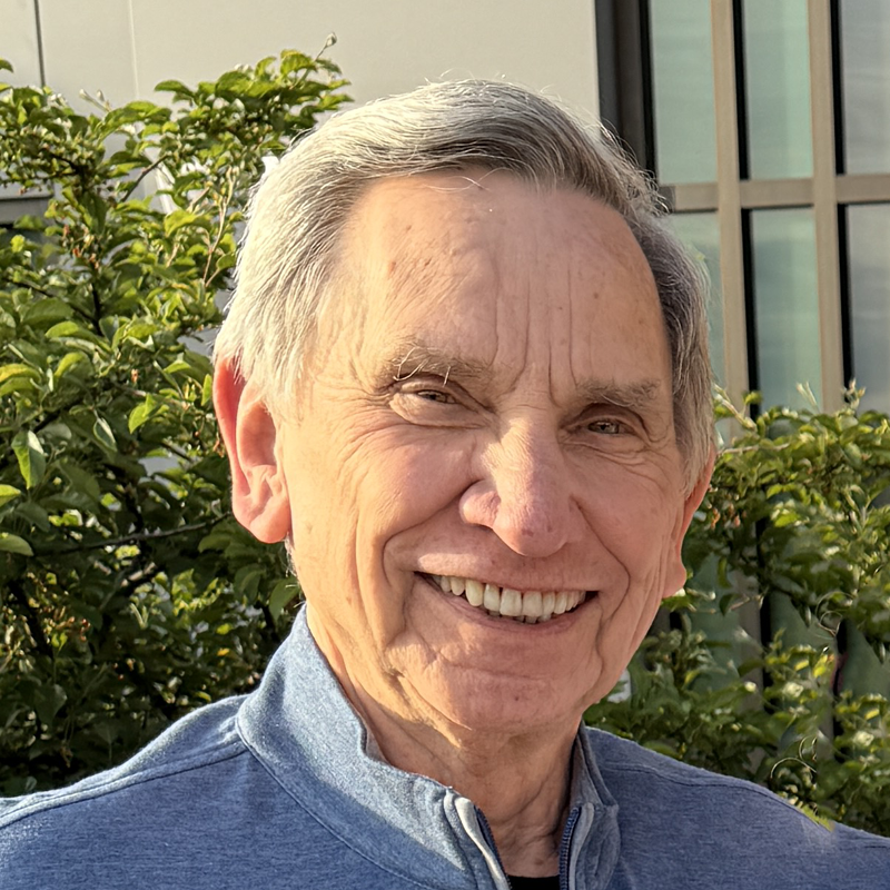
Steve, amateur radio operator N9WD
W6R OPERATING TEAM

STEVE

N9WD

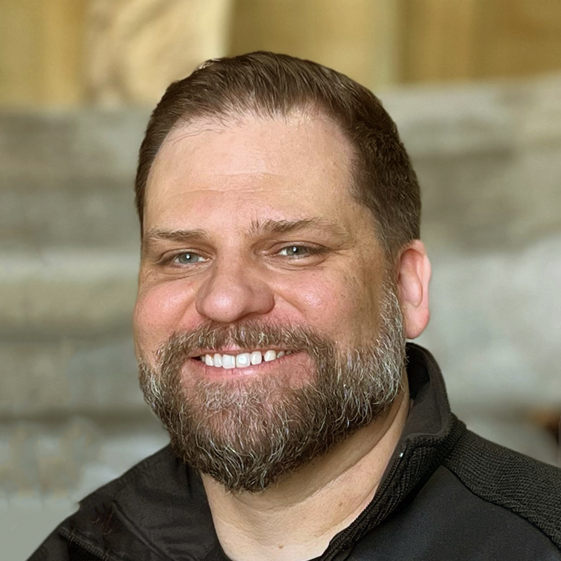
Todd, amateur radio operator K9XH
W6R OPERATING TEAM

TODD

K9XH

Mike, amateur radio operator WB8VVK
W6R OPERATING TEAM

MIKE

WB8VVK

LEAVE YOUR MARK

The Roadside
Logbook.

Did you meet us along Route 66, spot W6R on the road, or make contact with us on the air? Leave your name or callsign, tell us where you found us and add your mark to the journey.

Messages are reviewed before they appear publicly.

MESSAGES FROM THE ROAD
Be the first to say hello.

Approved messages from people we meet and operators who work W6R will appear here.